Publications
Highlights
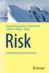
Risk - A Multidisciplinary Introduction
Editors: Claudia Klüppelberg, Daniel Straub, Isabell M. Welpe
Springer Cham Heidelberg New York Dordrecht London
ISBN: 978-3-319-04485-9 (Print), 978-3-319-04486-6 (Online)
Special Issue "Rock slope instability and erosion" published in in ESPL (17 papers)
Michael Krautblatter and Jeffrey R. Moore
ESEX Commentary, Earth Surface Processes and Landforms
Volume 39, Issue 9, pages 1273–1278, July 2014
DOI: 10.1002/esp.3578
Geo
- Krautblatter, M., Funk, D., Guenzel, F., (2013) Why permafrost rocks become unstable: a rock–ice-mechanical model in time and space. Earth Surf. Process. Landforms 10.1002/esp.3374.
- Krautblatter, M., Moser, M., Schrott, L., Wolf, J., Morche, D., (2012.) Significance of rockfall magnitude and carbonate dissolution for rock slope erosion and geomorphic work on Alpine limestone cliffs (Reintal, German Alps). Geomorphology 167, 21-34
- Steigenberger P., Seitz M., Böckmann S., Tesmer V., Hugentobler, U. (2012) Precision and accuracy of GPS-derived station displacements. Physics and Chemistry of the Earth 53-54, 72-79, 10.1016/j.pce.2010.07.035
- Boetticher, A. (2012): Flexible Hangmurenbarrieren: Eine numerische Modellierung des Tragwerks, der Hangmure und der Fluid-Struktur-Interaktion. Dissertation, Lehrstuhl für Statik, Technische Universität München.
- Becker T., Nagel C., Kolbe T. H. (2011) Integrated 3D Modeling of Multi-utility Networks and their Interdependencies for Critical Infrastructure Analysis. Lecture Notes in Geoinformation and Cartography, Springer Heidelberg
- Boetticher, A.; Volkwein, A.; Wüchner, R.; Bletzinger, K.-U.; Wendeler, C. (2011): Numerical modeling of shallow landslide impacts on flexible protection systems and its validation with full scale testing. In: Papadrakakis, M.; Oñate, E.; Schrefler, B. (eds) Computational Methods for Coupled Problems in Science and Engineering IV: Proceedings of the IV International Conference on Computational Methods for Coupled Problems in Science and Engineering held in Kos, Greece, 20-22 June 2011. Barcelona, International Center for Numerical Methods in Engineering (CIMNE)
- Heng L., Lee G.H., Fraundorfer F., Pollefeys M. (2011) Real-time photo-realistic 3D mapping for micro aerial vehicles. IEEE/RSJ International Conference on Intelligent Robots and Systems (IROS)
- Thuro K., Singer J., Festl J., Wunderlich Th., Wasmeier P., Reith Ch., Heunecke O., Glabsch J., Schuhbäck St. (2010) New landslide monitoring techniques – developments and experiences of the alpEWAS project. – Journal of Applied Geodesy 4: 69-90
- Krautblatter, M., Moser, M., (2009) A nonlinear model coupling rockfall and rainfall intensity based on a four year measurement in a high Alpine rock wall (Reintal, German Alps). Nat. Hazards and Earth System Sciences 9, 1425-1432
- Moser, M.; Wunderlich, Th.; Meier, H., (2009) Kinematische Analyse der Bergzerreißung Hornbergl – Reutte ( Tirol), Jahrbuch der Geologischen Bundesanstalt, Band 149, Heft 1, Geologische Bundesanstalt Wien, S. 177-193
- Eineder, M., Bamler, R., Cong, X., Gernhardt, S., Fritz, T., Zhu, X. X., Balss, U., Breit, H., Adam, N., Floricioiu, D.: Globale Kartierung und lokale Deformationsmessungen mit den Satelliten TerraSAR-X und TanDEM-X, ZFV – Zeitschrift für Geodäsie, Geoinformation und Landmanagement, 1/2013, pp. 75-84, 2013.
- Cong, X., Balss, U., Eineder, M., Fritz, T.: Imaging Geodesy—Centimeter-Level Ranging Accuracy with TerraSAR-X: An Update, IEEE Geoscience and Remote Sensing Letters, 9 (5), pp. 948-952, 2012.
- Rossi, C., Rodriguez Gonzalez, F., Fritz, T., Yague Martinez, N., Eineder, M.: TanDEM-X calibrated Raw DEM generation, ISPRS Journal of Photogrammetry and Remote Sensing, 73, pp. 12- 20, 2012.
- Yague-Martinez, N., Eineder, M., Cong, X., Minet, C.: Ground Displacement Measurement by TerraSAR-X Image Correlation: The 2011 Tohoku-Oki Earthquake, IEEE Geoscience and Remote Sensing Letters, 9 (4), pp. 539-543, 2012.
- Zhu, X. X., Bamler, R.: Demonstration of super-resolution for tomographic SAR imaging in urban environment, IEEE Transactions on Geoscience and Remote Sensing, 50 (8), pp. 3150-3157, 2012.
Hydro
- Heimhuber, V., Hannemann, J.-C. & W. Rieger (2015) Flood risk management in remote and impoverished areas – A case study of Onaville, Haiti. In: Water 2015, 7, 3040-3056; doi:10.3390/w7063040
- Bui M. D., Rutschmann P. (2010) Numerical modelling of non-equilibrium graded sediment transport in a curved open channel. Computers & Geosciences, Vol. 36, 792-800
- Gobert C., Link O., Manhart M., Zanke U. (2010) Discussion of ''Coherent Structures in the Flow Field around a Circular Cylinder with Scour Hole'' by G. Kirkil, S.G. Constantinescu, and R. Ettema. J. Hydraulic Engineering 136(1), 82-84
- Wendeler, C. (2008) Murgangrückhalt in Wildbächen - Grundlagen zu Planung und Berechnung von flexiblen Barrieren. DISS. ETH Nr. 17916, ETH Zürich. Co-Betreuung von Lehrstuhl für Statik, Technische Universität München.
- Näf D., Rickenmann D., Rutschmann P., McArdell B. (2006) Comparison of friction laws for debris-flows with a 1D FEM simulation model. Natural Hazards and Earth System Sciences 6, 155-165
Risk
- Špačková O., Straub D. (2015): Cost-benefit analysis for optimization of risk protection under budget constraints. Risk Analysis, 35(5):941–959
- Sättele M., Bründl M., Straub D. (2015): Reliability and Effectiveness of Warning Systems for Natural Hazards: Concepts and Application to Debris Flow Warning. Reliability Engineering & System Safety, 142: 192-202
- Sättele M., Krautblatter M., Bründl M., Straub D. (in print): Forecasting rock slope failures: How reliable and effective are warning systems? Landslides
- Straub D. (2014): Engineering Risk Assessment. Chapter 12 in: Risk - A Multidisciplinary Perspective (eds. Klüppelberg C., Straub D., Welpe I.), Springer
- Špačková O., Rimböck A., Straub D. (2013): How to select optimal mitigation strategies for natural hazards? Proc. ICOSSAR 2013, Columbia University, New York
- Straub D., Schubert M. (2008) Modelling and managing uncertainty in rock-fall hazards. Georisk, 2(1), pp. 1-15
- Grêt-Regamey A., Straub D. (2006) Spatially explicit avalanche risk assessment linking Bayesian networks to a GIS. Natural Hazards and Earth System Sciences, 6(6), pp. 911-926
Interdiciplinary
- Eder K., Rapp C., Kohl V., Hanrieder B., Stilla U. (2011) Photogrammetric monitoring of under water erosion in the vicinity of cylindrical bridge piers. Archives of the Photogrammetry, Remote Sensing and Spatial Information Sciences, 38 (3W/22): 167-172
- Glabsch J., Heunecke O., Schuhbäck S. (2010) A low cost PDGNSS based sensor network for landslide monitoring – challenges, possibilities, and prospects. International Journal of Digital Earth (IJDE). Issue 4, Taylor & Francis
- Krautblatter, M., Verleysdonk, S., Flores-Orozco, A., Kemna, A., (2010.) Temperature-calibrated imaging of seasonal changes in permafrost rock walls by quantitative electrical resistivity tomography (Zugspitze). J. Geophys. Res.-Earth Surface 115, F02003.
- Steinmetz T., Raape U., Teßmann S., Strobl Ch., Friedemann M., Kukofka T., Riedlinger T., Mikusch E., Dech S. (2010) Tsunami early warning and decision support. Natural Hazards and Earth System Sciences. 01/2010; 10(2010-09-06):1839-1850
- Thuro K., Wunderlich T., Heunecke O., Singer J, Schuhbäck S., Wasmeier P., Glabsch J., Festl J. (2009) Low cost 3D early warning system for alpine instable slopes - the Aggenalm landslide monitoring system. Geomechanics and Tunnelling, 221-237