GeoSPOT: Geologische Nutzungs- und Speicherpotenziale im quartären und tertiären Untergrund des Großraums Augsburg
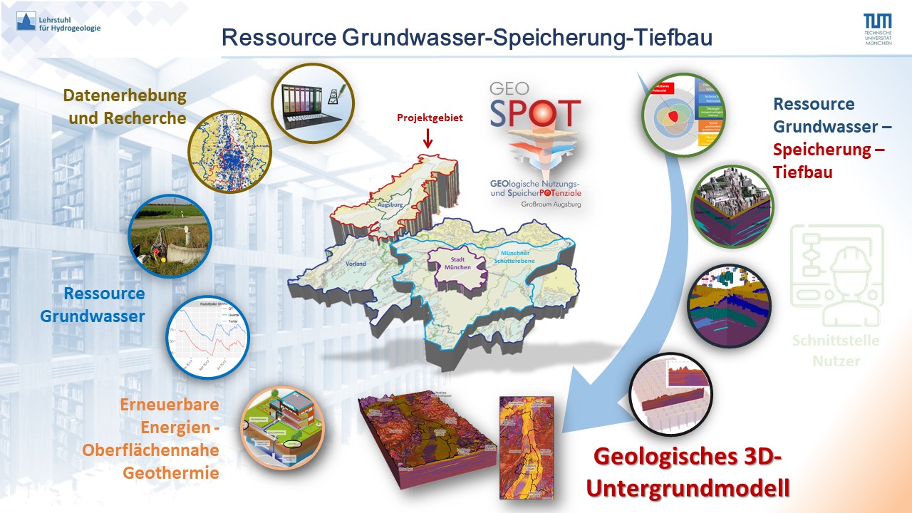
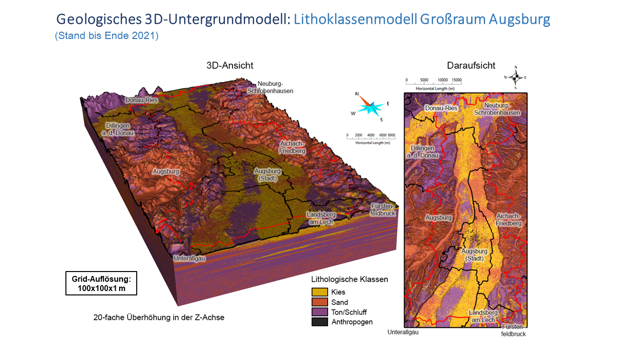
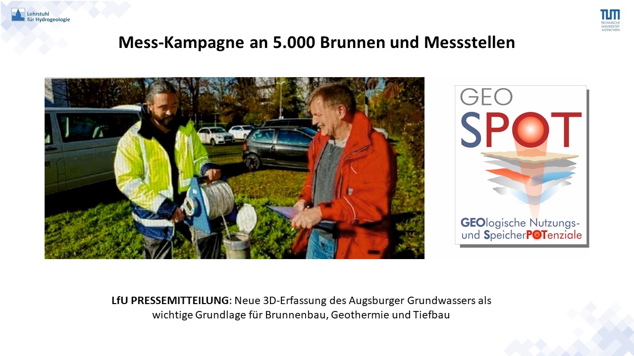
The subsurface provides important natural resources and offers a wide range of storage possibilities (water, gas, CCS, heat). However, in order to make optimum and efficient use of the existing (geo)potentials and at the same time preserve the resources, primarily the groundwater, for future generations, sustainable and future-oriented spatial planning of the underground will be necessary. An optimal and efficient management of the geopotentials in the subsoil therefore requires on the one hand the area-wide survey of the geoscientific information basis, and on the other hand the detailed recording and delimitation of the geopotentials in the depth, consequently with a three-dimensional view. The “GeoSPOT” projects aims to determine the usable geopotentials, especially the relevant storage potentials exemplarily for an urban area in Bavaria as a pilot study. The wider area of Augsburg is chosen as the geological conditions and the already existing demand offer ideal conditions. The research goals include the first-time gathering and evaluation of comprehensive, three dimensional geological and hydrogeological data with focus on the usage of geo- and storage potentials. Especially the specification and parametrization of the potentials of the shallow geological layers in a 3D-model are key points. Furthermore, the enhancement of the 3D-geological lithofaciesmodel of Munich (GeoPot-project) for user-specific applications will be conducted. The “GeoSPOT Project” is financed by the “Bavarian State Ministry of Environment and Public Health (StMUV)”, supervised by the “Bavarian Environment Agency (LfU)” and realized by the “Chair of Hydrogeology - Technical University of Munich (TUM)” between 2020 and 2023.
Responsible
Dr. Kai Zosseder; Dr. Lilian Chavez-Kus; M.Sc. Marco Kerl; Dipl.-Ing. Alberto Albarrán Ordás; Dr. Aleksandra Kiecak; M.Sc. Stefanie Küster; Dipl.-Ing. Tobias Schmetzer
Project duration
01.01.2020 - 31.12.2023
Funded by
Bavarian State Ministry of the Environment and Consumer Protection; Bavarian Environment Agency
Related projects
3D-GeoModell Berlin; Energie Atlas Bayern; Geo-KW; GeoPot; GePo
Related reports
Last Update: Januar 25, 2023