DanubeSediment Project
01. Jan. 2017 - 30. Nov. 2019
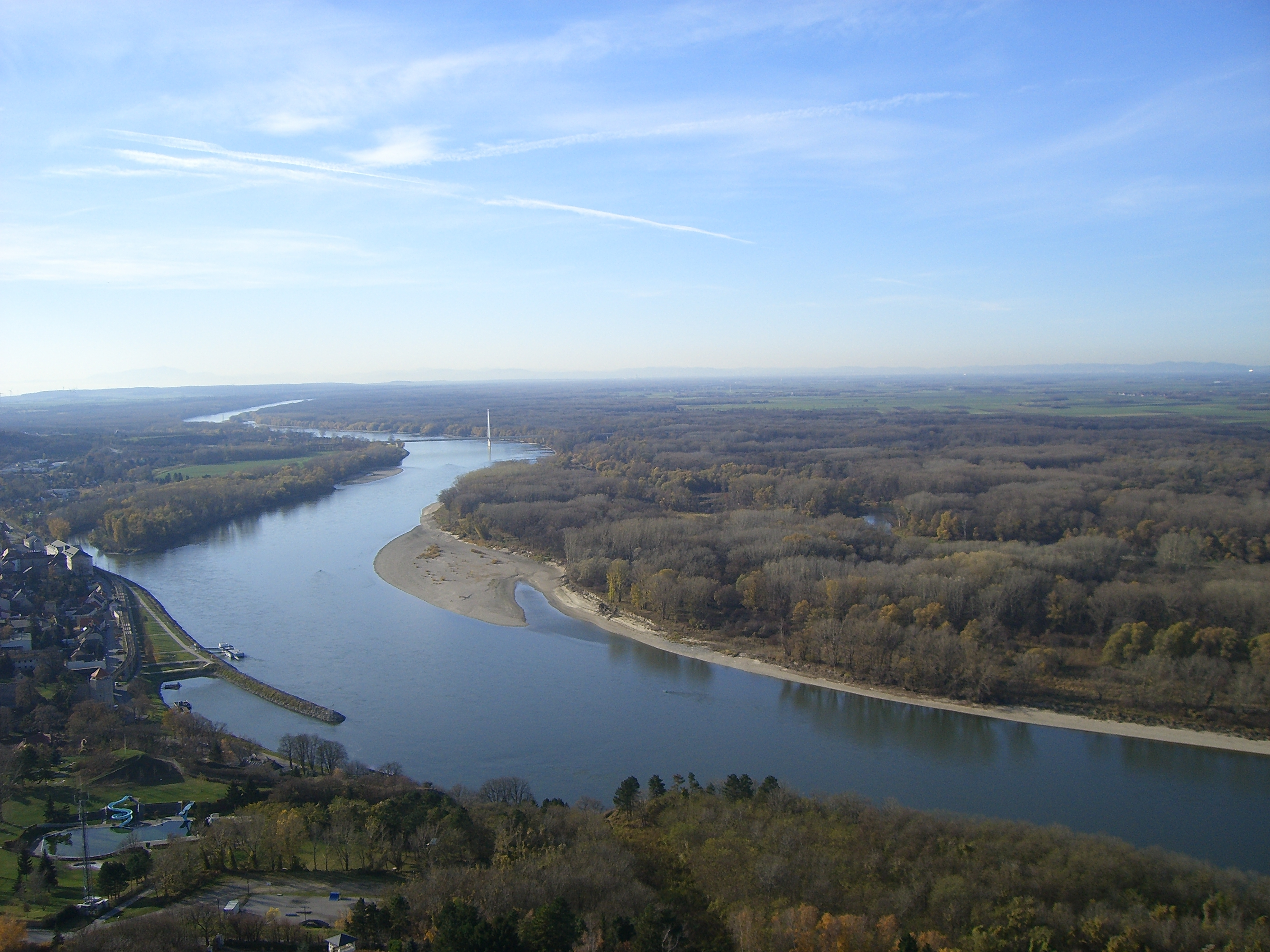
Sediments are a natural part of aquatic systems. During the past centuries, humans have strongly altered the Danube River. Riverbed straightening, hydropower dams and dykes have led to significant changes in the sediment load. This sediment imbalance contributes to flood risks, reduces navigation possibilities and hydropower production. It also leads to the loss of biodiversity within the Danube Basin.
More than a decade ago, the International Commission for the Protection of the Danube River (ICPDR) identified a changed sediment regime in the Danube River as an issue. As the Danube flows through ten counties from the Black Forest to the Black sea, a transnational project on sediment management was needed to obtain a full picture. The aim was to improve the sediment and water management as well as the morphology of the Danube River. To tackle these challenges, 14 project partners and 14 strategic partners came together in the DanubeSediment project for almost three years. The partnership included numerous sectoral agencies, higher education institutions, hydropower companies, international organisations and nongovernmental organisations from nine Danubian countries. With a budget of 3.56 million Euro, the DanubeSediment project was co-funded by the European Union ERDF and IPA funds in the frame of the Danube Transnational Programme.
Closing knowledge gaps: In a first step, the project team collected sediment transport data in the Danube River and its main tributaries. This data provided the foundation for a Danube-wide sediment balance that analysed the sinks, sources and redistribution of sediment within the Danube. In addition, the different monitoring instruments and methods used to collect sediment data by the Danubian countries were compared. The project recommends establishing a harmonized quantity monitoring network, setting-up new monitoring stations and a centralised data storage. In order to understand the impacts and risks of sediment deficit and erosion, the project partners analysed the key drivers and pressures causing an alteration of the sediment balance.
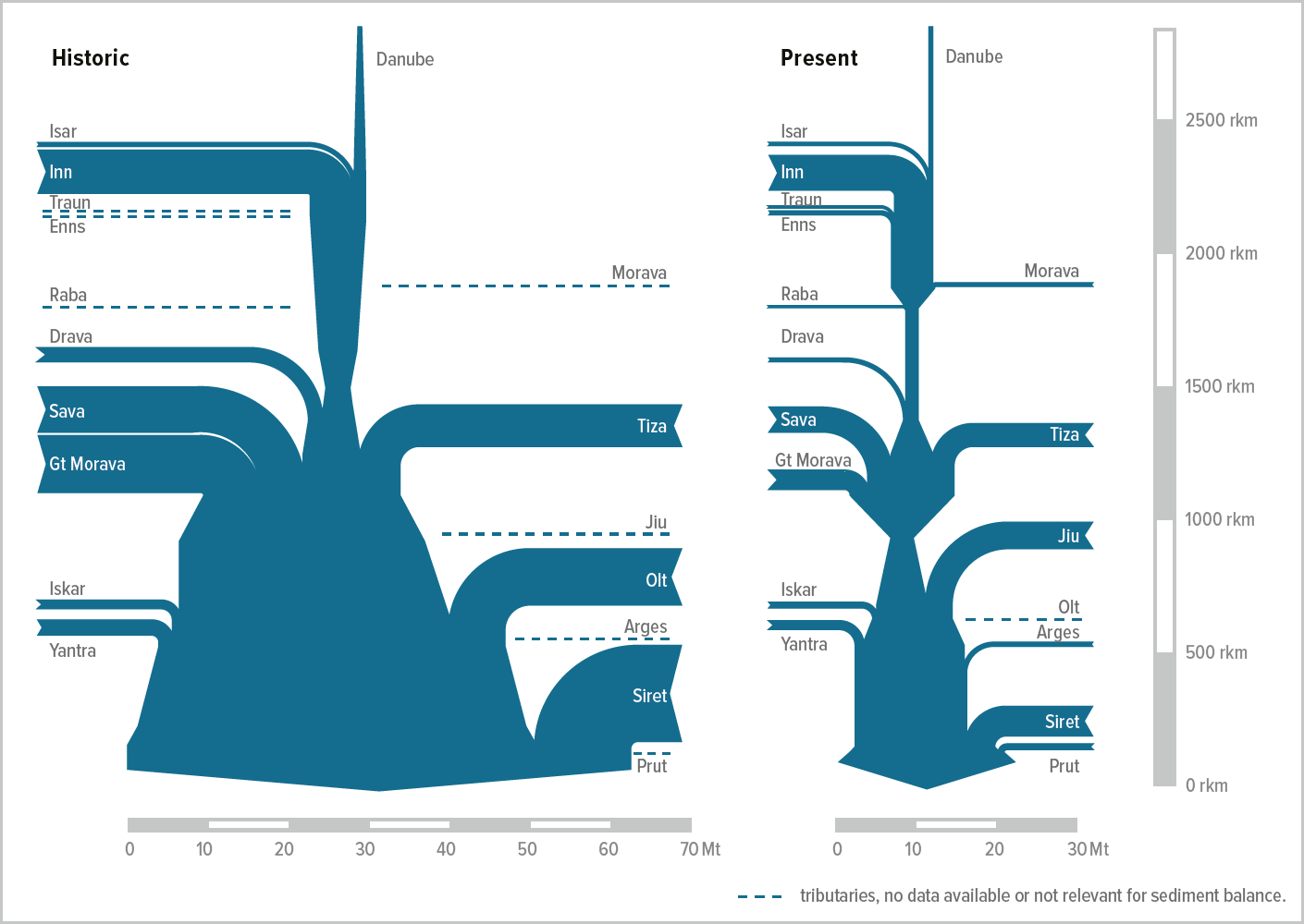
Overall, our project results confirmed the assumption that there is a sedimentation tendency when the river is dammed, while erosion mainly occurs in the free-flowing river sections. One result of the sediment regime analysis can be seen in the following figure: Since the construction of the major hydropower plants, the total suspended sediment input to the Danube Delta and the Black Sea decreased by more than 60 %. The suspended sediment load decreased from former amounts of about 40-60 Megatons per year to approximately 15-20 Megatons per year nowadays. To calculate the whole sediment balance, our partners also analysed bathymetrical data, bed material as well as dredging and feeding. In total, about 733 river kilometres of analysed river length is dominated by erosion. In the Lower Danube, 670 kilometres show an erosional trend, especially downstream of the Iron Gate 2, but a lack of data hinders a detailed analysis, meaning local sedimentation may exist in stretches of general riverbed erosion. When we add this up, over half of the Danube River shows a tendency to erosion, whilst 857 river kilometres are dominated by sedimentation, especially in front of the major hydropower plants Aschach, Gabčíkovo and Iron Gate 1. Only around 10% of the analysed river stretch (i.e. 241 kilometres) shows a dynamic balance between sedimentation and erosion.
Strengthening governance: One main project output is the Danube Sediment Management Guidance (DSMG). It contains recommendations for reducing the impact of a disturbed sediment balance, e.g. on the ecological status and on flood risk along the river. By feeding into the Danube River Management Plan (DRBMP) and the Danube Flood Risk Management Plan (DFRMP), issued by the ICPDR, the project directly contributes to transnational water management and flood risk prevention.
International stakeholder workshops supported the transfer of knowledge to key target groups throughout the Danube River Basin, for example hydropower, navigation, flood risk management and river basin management, which includes ecology. These target groups were also involved in the development of the project results, for example in the frame of national events. The project specifically addresses the key target groups in its second major output: the Sediment Manual for Stakeholders. The document provides background information and concrete examples for implementing good practice measures in each field. The project reports can be found here. The project also created two videos and interactive maps to visualise the project results and recommendations. For further details, please visit the DanubeSediment Project website.
Contact:
Markus Reisenbüchler
Email: markus.reisenbuechler@tum.de